New way of mobile measurement operation.

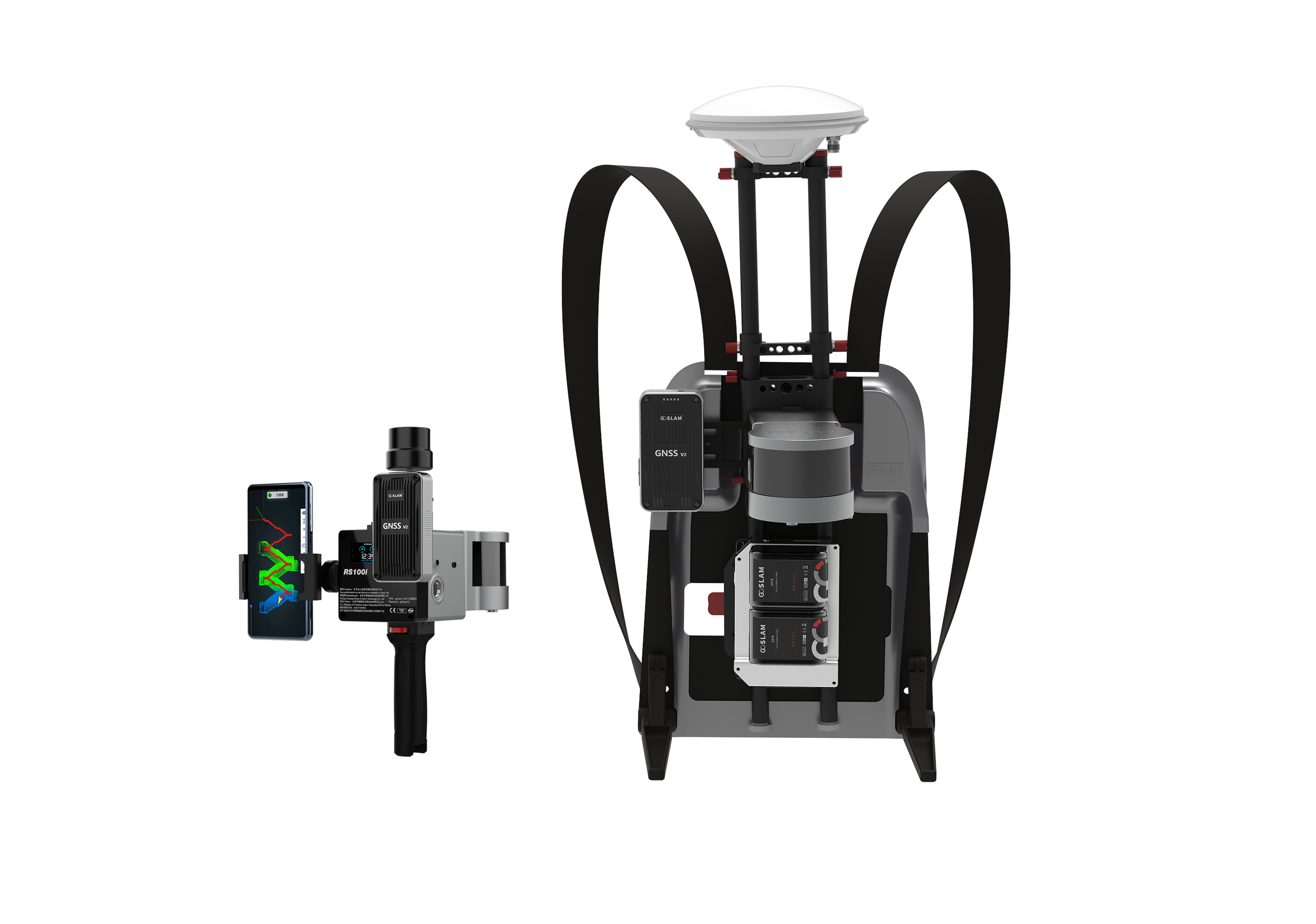
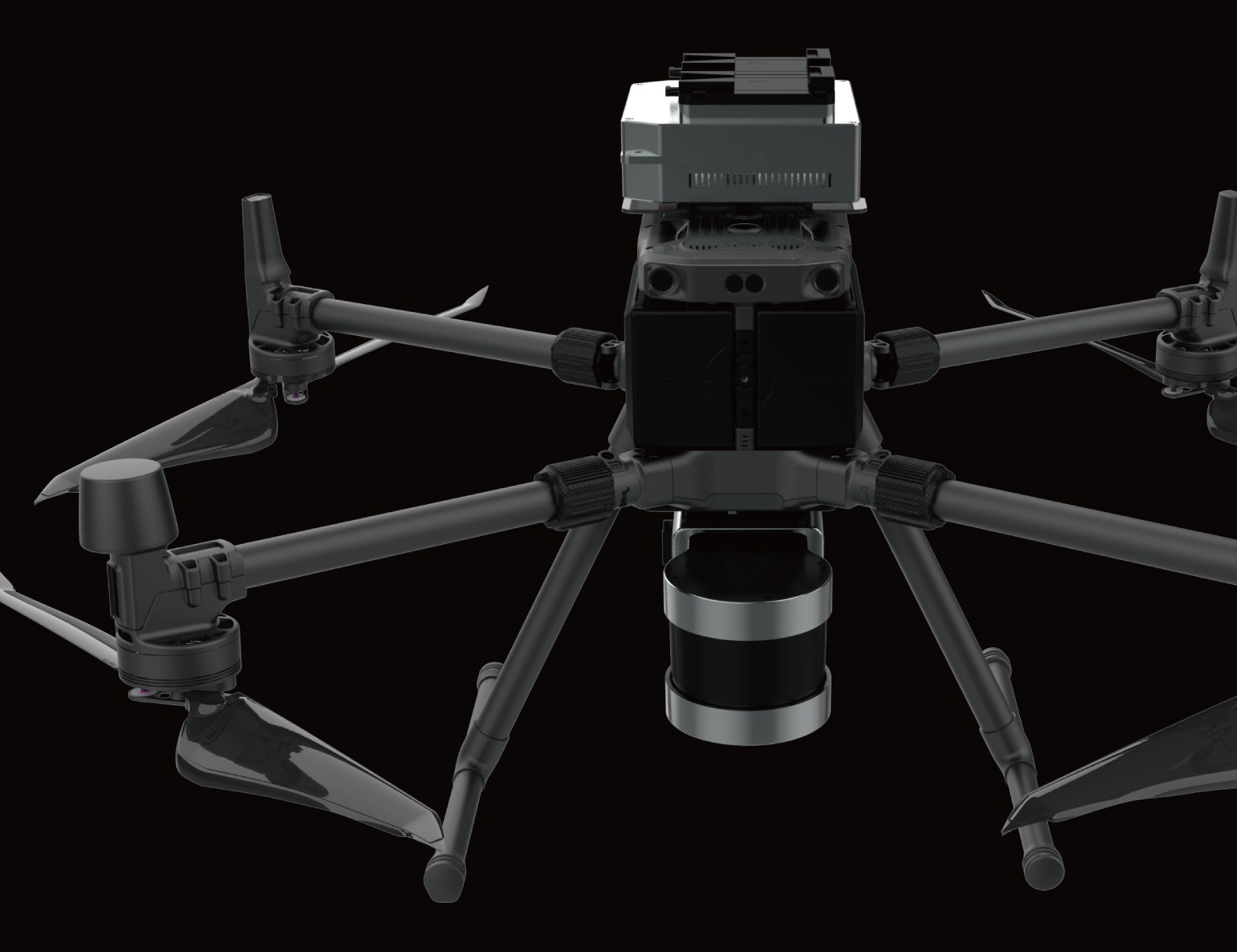
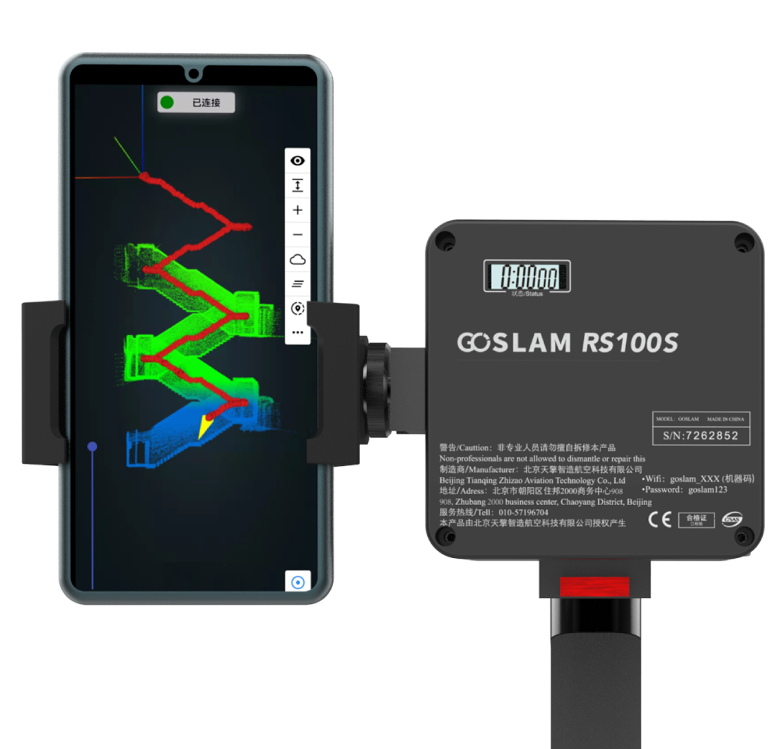
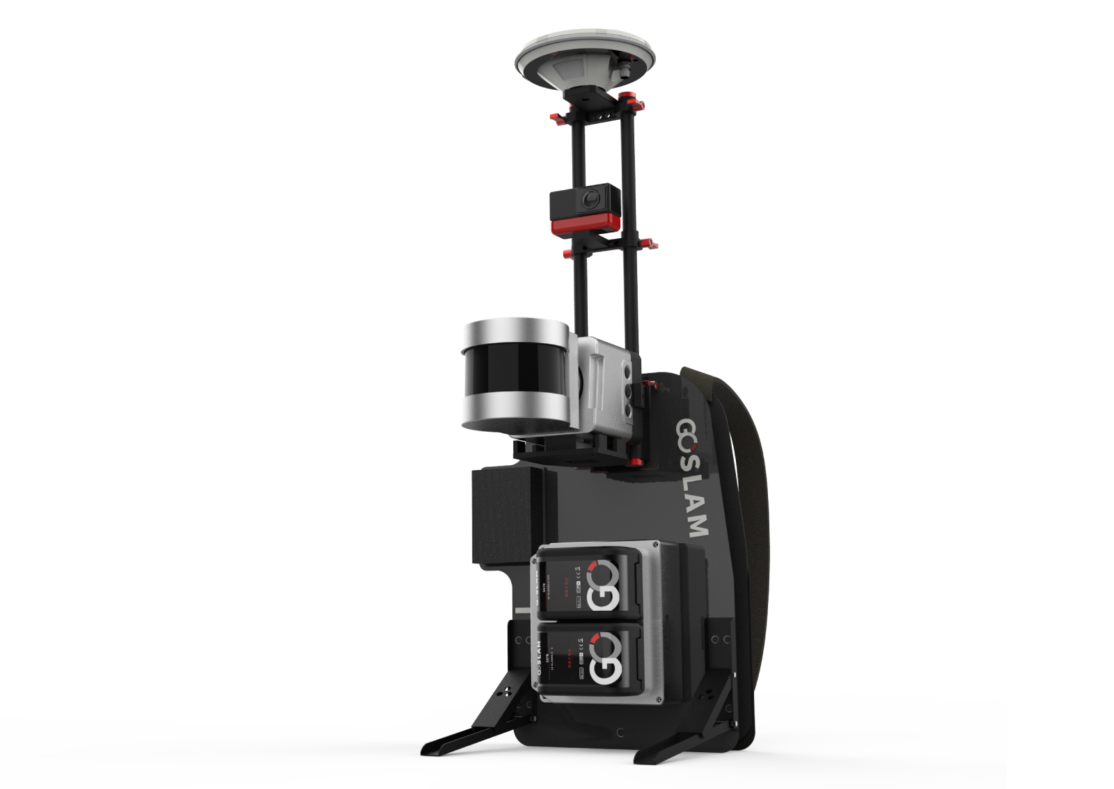
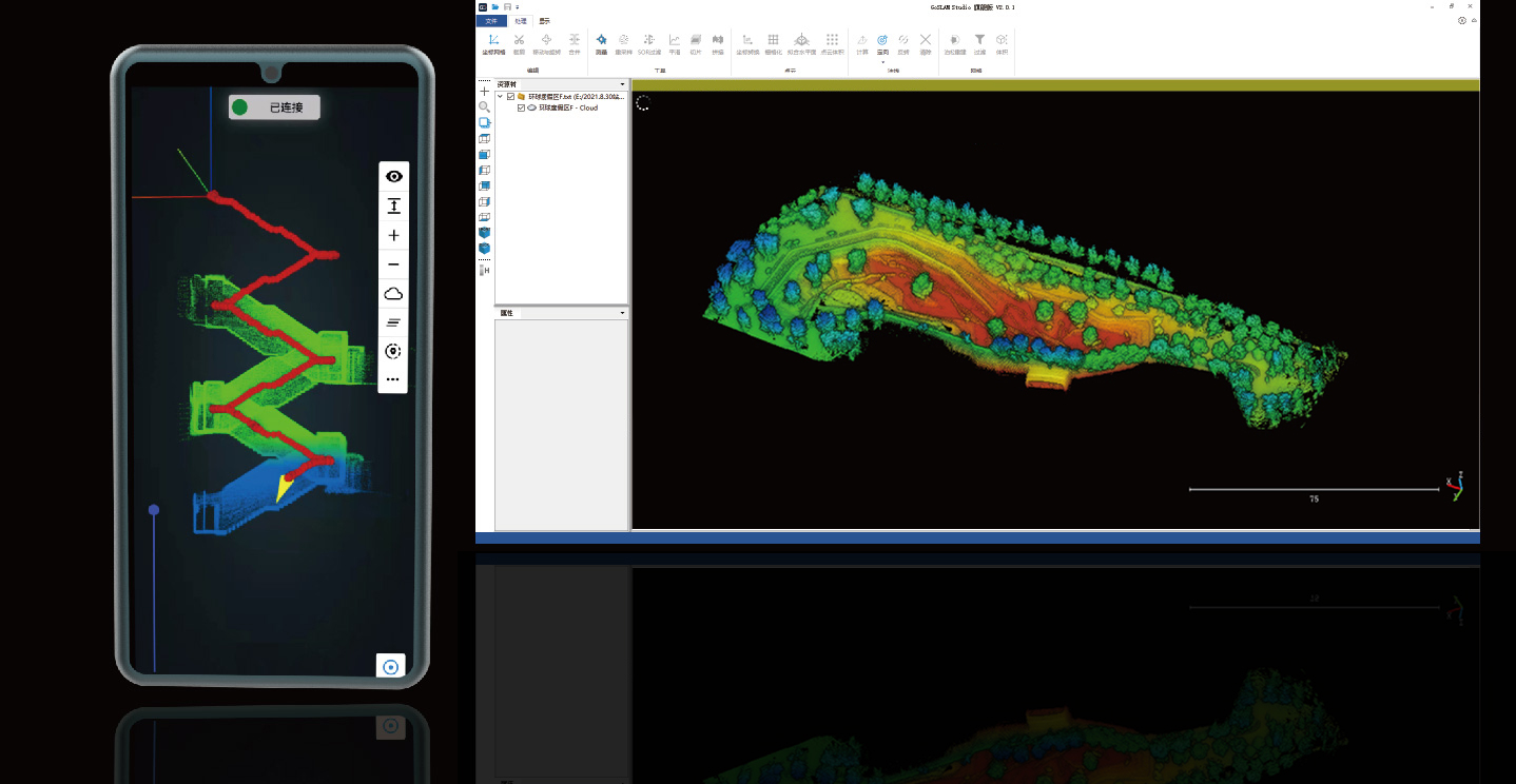
The GoSLAM RS100i mobile scanner supports a variety of scanning modes and is suitable for a variety of application scenarios. GNSS module can be switched quickly, supporting scanning to obtain WGS84 and CGCS2000 coordinate system point cloud, using the second generation of mapping program, absolute accuracy of about 2cm.

For information of full product coverage, please go to https://goslam.com/


Tags: 3D scanner / Handheld / Light weight / SLAM / Color capture / Software development kit / 3D Mapping/ Battery operated

View More

GoSLAM mobile measurement system adopts SLAM technology (Simultaneous localization and Mapping), that is, real-time positioning and mapping technology does not depend on GNSS positioning such as GPS. In the movement of unknown environment such as indoor and outdoor space, self-positioning and incremental 3D mapping are carried out. GoSLAM is committed to providing customers with solutions for mobile 3D laser measurement systems with a better user experience.


Request Quote

GoSlam RS100i Key Features

Super weather resistance and multi-platform support
RS100S system is extremely weatherable and can operate at -30-60℃. It is compatible with backpack, uav, vehicle and other mobile platforms
Color Module
As the true color scheme of GoSLAM point cloud, the color module is plug and play, without complicated operation of additional image import, integrated synchronous collection, the data can be fully automatic color point cloud coloring and panoramic image point cloud linkage.
Real-Time Preview Of Mobile APP
Mobile apps replace traditional touch screens. Browse point cloud data in real time through APP during operation. It supports a variety of browsing interaction and more human-computer interaction content
Hybrid solution technique
RS100S product has a unique hybrid solution technology. This ensures higher accuracy and improves the speed of its own solution. It greatly improves the scanning efficiency to match the post-processing software
Strong performance
Equipped with a rotating laser probe, with a range of 120 meters, collecting 320,000 points per second, and a relative point accuracy of 1cm (with low reflectivity extended range mode); at the same time, it can be modified and upgraded to RS100S-RTK backpack mapping system, which is more suitable for various outdoor applications scene scan
Supporting post-processing software
GoSLAM Studio Flagship Version software is specially designed and developed for the GoSLAM series of mobile 3D scanners, integrating device application and point cloud processing. It is also compatible with third-party device point cloud processing.
The software has eight basic functions: one-click point cloud denoising, point cloud splicing, shadow rendering, coordinate transformation, automatic horizontal plane fitting, automatic point cloud data report generation, forward photography and point cloud encapsulation. GoSLAM adds one-click heap data generation to bulk metering to make it easier to access data.

Industrial Applications

Stack measurement

It has advantages in volume inventory of coal pile, ore pile, material and granary. DS100 is based on laser scanning and SLAM positioning technology. It can perform fast, mobile scanning operations in shed and outdoor environments, without GPS. The cloud can be seen in real time with high precision and fast speed, and the unique ultra-low reflectivity range extension function is particularly effective for coal pile and mineral materials. This has incomparable advantages over other measurement methods.

Building information collection

Based on multi-platform development, it can be carried by hand-held, backpack, vehicle-mounted or unmanned aerial vehicle, with a unique dual probe scanning frequency of 1.3 million points/second. It can move faster for data collection and high-density spatial information collection of all kinds of building information, such as modern real estate, urban housing, rural cadastre, building facade, ancient buildings, etc., for internal 3D modeling and drawing.

Digitization of underground facilities

GoSLAM DS100 products based on SLAM localization technology do not require GPS. Fast 3D data acquisition can be carried out both indoors and outdoors, and high-quality point cloud data can be obtained without the influence of bright or dark environment. DS100 system can be used to collect complete and accurate spatial information for underground parking lots, civil air defense facilities, shopping malls and airports, large-scale facilities of factories and mines.

Survey and mapping

The flexible and versatile GoSLAM DS100 system can switch between hand-held and unmanned aerial vehicle at will. DS100 can deal with trees or narrow village laneways in a leisurely manner.

Agriculture, Forestry, geology

Complex site environment of agriculture, forestry and geology and high density coverage. It has always been a difficult area for 3d data acquisition. The advent of SLAM technology has solved the problem in this field. The GoSLAM DS100 product features 360×360 degree scan coverage with dual laser heads. This method can collect the three-dimensional information of the horizontal and vertical surface of the tree crown to a large extent. Agricultural growth, forestry green quantity and geological survey are no longer difficult.

CONTACT US FOR A DEMO

Case Study

Applications for GoSLAM (Video)

Relative accuracy up to 1 cm, powered by #SLAM algorithm, The GoSlam 3D scanner is able to operate on both indoors and outdoors. The scanner is able to be mounted on vehicle, drone and backpack. The video shows the various case studies based on different applications.

Video (4 min.)

Downloads

R100i Brochure

WHICH 3D SCANNER? TALK TO US TO KNOW MORE